Excerpts from last year's field tour of Colorado, New Mexico and Texas.
Thursday May 17 2012
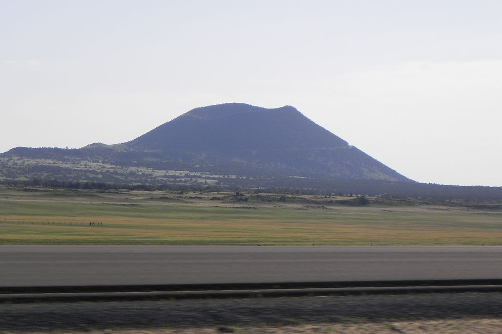
9am - arrive Capulin Volcano
The Capulin volcano is one volcano in a volcano field that is approximately 60,000 years old. It is unusual for dormant volcanoes, because of its forested habitat.
Trees: ponderosa, juniper, pinyon,
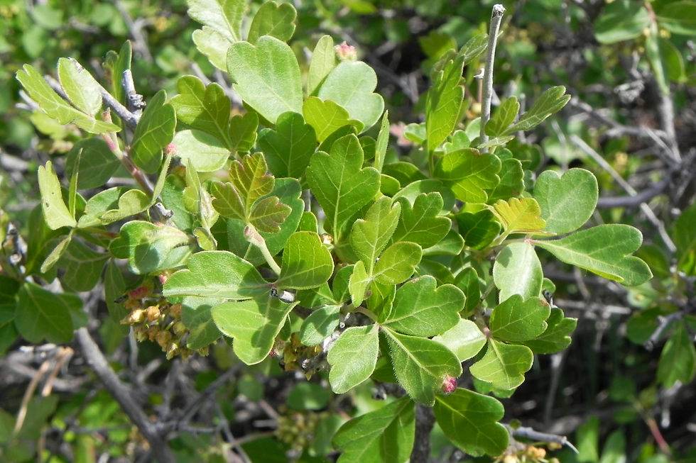
Shrubs: thimbleberry, oakbrush, mountain mahogany, alder, chokecherry, skunk brush sumac, fringed sage, ribes, wax current, primrose, wildrose,
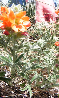
Forbs: lupine, paintbrush, eriogonum, salsify, pea flower, bluebells, astralagus, horehound, penstemon, buckwheat, dandelion, wooly lambs ear,
Cacti: opuntia, yucca
Grasses: blue grama, buffalograss, western wheat, sideoats grama, blue grass, sand drop seed, cheat grass
Friday May 18, 2012
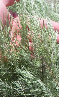
700am - Identified Apache Plume and Desert Ceonothus in the campground.
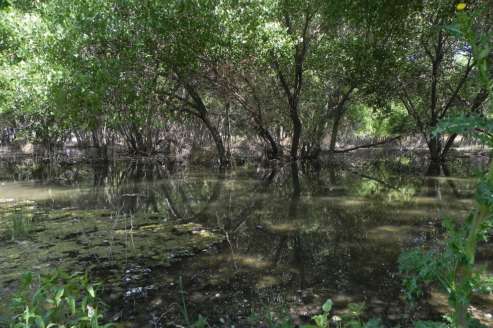
8:30am - off to the Guadalupe visitor center and to hike into Mckittrick Canyon to the Pratt cabin and the Grotto (~6.5 mile hike rt) took us ~4-5hrs.
The Mckittrick canyon was settled in the 30’s by a geologist. He built a rock home 3 miles up the canyon. He describes the travertine on the rocks in the creekbed (calcium carbonate that dropped out of solution in the water) , the wildlife, and the interesting plant communities. There is evidence that the canyon was inhabitated 12,000 years ago. More recently the Mescalero Apaches used these canyons and hid out from invading cavalry.
930 AM Started the hike up the canyon.
Wednesday May 16 2012
~ 10 miles S on 287 from Kit Carson we stopped alongside the hwy to look at a sand-sage dominated plant communitiy and collect specimens. OBSERVED: 3 awn spp(2x), Scarlet globemallow, Bouteloua curtipendula pineapple weed, horned toad, yucca, primrose, SPCO, stickseed, cheatgrass, sand drop seed, salsify, aguara, chamilla, milkweed, astragalus spp. (2x)
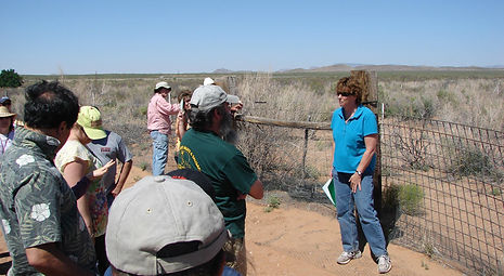
2: 45pm met up with Tim Steffens NRCS who took us to a private Ranch S of Holly ~10 miles. The area of the ranch we were on had really sandy soils and consisted of a sandsage shrubland with stickseed, yucca, vulpia,salsify, gallarida, 3-awn, and a tall mystery grass we never figured out.
Shrub Ecology Field Tour 2012
Time Steffens discussed the difficulty of managing for the diverse requirements of lesser prairie chicken nesting and brood rearing habitat. Lesser prairie chickens require tall grasses, shrub cover, bare ground and plenty of forbs which positively correlate with their insect requirement. These vegetation components meet their needs for the visual obscuring of nests from predators, ease of movements for brooding chicks, and forage. Steffens suggested that one way to meet these requirements was to manage for heterogeneity in the landscape using livestock to utilize areas differentially. Steffens recommends a strategy of exclusively altering grazing intensity, location and timing. Regions that have inadequate shrub cover for nesting, should be excluded from grazing or grazed lightly to allow shrub establishment. Steffens closed with advice for us all to not get PhDs. Departed at 5pm enroute for Raton, Nm


1100am Arrived at the Pratt Canyon after hiking up through the Maple and Juniper forest. We saw many different plant species in the canyon.
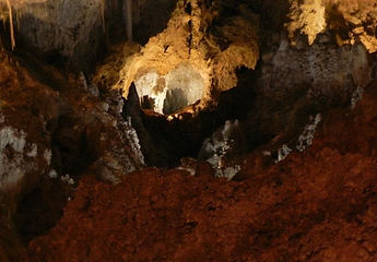
1200pm Arrived at the Grotto which is a small cave opening in the cliff face. covered in stalagtites and stalagmites. We noticed that as we gained elevation there were more maple and ponderosa. There were even ferns on the canyon walls. We observed:
Trees: Texas madrone, alligator juniper, desert willow, ponderosa, Vine maple, mulberry, walnut, Ptelea trifoliata
Shrubs: Apache plume, mistletoe growing on oak, catclaw acacia, little leaf sumac, desert ceanothus, creosote, sotol
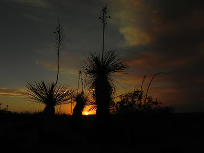
Cacti: sotol, agave, yucca, opuntia, cholla,
Forbs: Mexican orange plant, beargrass, penstemon spp., milkweed, mariola, ambrosia dumosa, mosses
~330pm arrive at Carlsbad Caverns, took tour (1.5mile loop, ~1hr)
The carlsbad canyons were first created by reef animals when the area was a sea. Then uplift occured and the softer deposits were eroded away leaving the caverns. Calcium carbonate forms spleotherms through time with the movement of water.
We observed ratany, javalina bush, shin oak, meriola, feather dahlia, ephedra, snakeweed, creosote and catclaw acacia.
Saturday May 19, 2012
8:42am - left Guadalupe camp ground headed to Carrizozo, down through the alkali flats, into creosote community and smaller mesquite country. Small zone of grasses before the salt flat. saw mexican orange, tobosa grass, alkali sacatone, gramma’s, 4 wing saltbrush
9:45am - arrive at Hueco water tanks park. The hueco tanks were formed by molten rock with was pushed upward and then cooled underneath of limestone. With time the limestone was worn away by water. Hollows in the rocks captured water that attracted many animals and people as they lived in or travelled through the area. The vegetation communities here are classified as Chihuahuan desert scrub and desert grassland. The igneous rock here holds water more effectively than it does elsewhere in the region creating for more diverse plant communities. Plant species here are soaptree yucca, honey mesquite, huckleberry, white oak, tarbush, ocatillo, agave, nightshade, sotol,and opuntia. Awesome, saw 8 masks in Kiva Cave. http://www.texasbeyondhistory.net/hueco/setting.html


Sunday May 20 2012
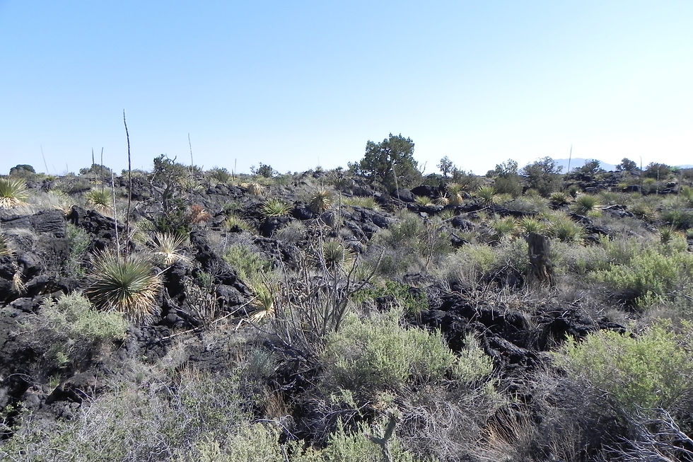
Carrizozo Valley of Fire: Lava flowed from vents in the surface up until a 1000 years ago Creating a 44 mile long by 25 mile wide path to the South east. The igneous surface makes for interesting small mammal, reptile and bird habitat and a more diverse plant community than found in the surrounding areas.
8am - headed to visitor center (closed since it was sunday), then walked the nature trail (~1.5miles), We observed a few new plants: bannana yucca (we ate some), african rue (an invasive) ,and sotol with reproductive stem. We also saw fourwing saltbush (male and female), skunkbrush sumac, pin cushion cactus, opuntia, side-oats grama, blue grama, a potential verbena, feather dahlia, meriola, mesquite, juniper, cholla, snakeweed, barberry, desert holly, desert willow, apache plume, ocatillo, globe mallow, Horsebrush, Wolfberry, african rue and winterfat.


Monday May 21 2012
7:15am - headed out of camp, had breakfast in Carrizozo.
8am - visit the valley of fire visitor center. Enroute we observe phacelia congesta, prickly poppy, gypsum weed, salt cedar, tall winterfat, alkali sackitone
830 Am - Depart Valley of the Fires Campground
845Am - Pj woodlands west of Carrizzozo, Heavy understory of grasses and winterfat. The Drainages have much higher forage production due to the accumulation of sediment runoff creating fertile soils trapping moisture. These drainage bottoms are the accumulating features of high productivity of grasses and the highest biomass of the area.
930am - San Antonio, Nm- Dropped into the Rio Grande drainage. lots of salt cedar and farm grounds. I25 Corrdior
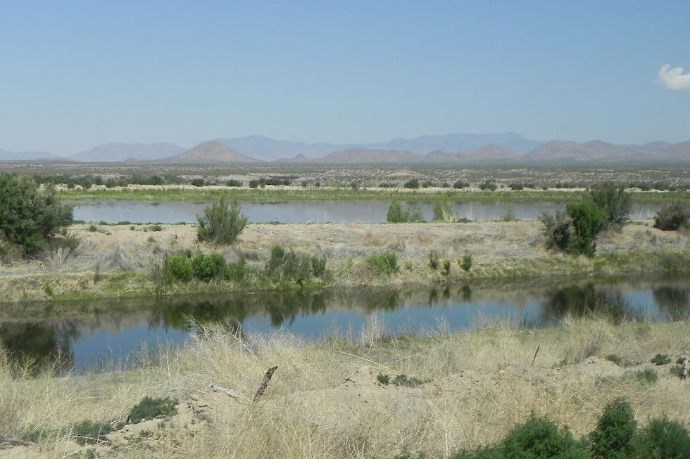
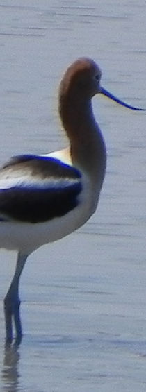
10am - arrive Bosque Del Apache wildlife refuge and take tour with Jon Vradenburg. The refuge hosts huge populations of migrant birds including a large population of sandhill cranes. He drove us out to sites in various stages of restoration. They restore to produce habitat for diverse types and high numbers of birds by focusing on the abiotic drivers of the system and by controlling the salt cedar. They have been much more successful in attracting birds when they use abiotic controls to manage for a broad range of habitats in various stages of succession instead of focusing on species-specific biotic requirements. They have a large canal system replete with intakes and outtakes that they use to flood various sections of the refuge and somewhat replicate the flooding that occurred before the Rio Grande was tied up in water uses and dams. They also can control vegetation communities that establish after flooding by the rate of draw-down they allow. One of the common habitats in the area before european-american settlement was salt-grass flats. To recreate these they draw the water down slowly.
Tamarisk is a big problem at the bosque. They have successfully removed it from many of their sites by using a combination of manual and chemical removal.
We saw elk on refuge, lots of salt cedar (9,000 acres of it), sedge, cocklebur and the invasive parrotleaf aquatic plant.
Tuesday May 22, 2012
8:15am - 5pm Woke up on the Jornada Agricultural Research Station. Attend the 17th Wildland Shrub Symposium in Las Cruces
6:30pm - dinner at Kris Havestad’s house, Supervisory Research Rangeland Management Specialist for the Jornada ARS.

Wednesday May 23 2012
8am - 4/5pm 17th Wildland Shrub Symposium in Las Cruces - Field Tours to White Sands Missile Base or Jornada Experimental Range (all day)
Jornada Experimental Range Tour:
We begin on the Chihuahan Desert Rangeland Research Center. At the first stop we are shown a picture of the same site where we are standing that was taken in 1948 that shows far more black grama and less mesquite then we observe now. We have the good fortune of being accompanied by John Hawley a geomorphologist who worked in the area in the 50’s. Hawley described how the basin was plugged by the RioGrande which drained into a large lake with no outlet until a volcanic event released it. Upon its release the Rio Grande drained the former high water tables (as evidenced by large gypsum crystals) of the basin. The sand here is mostly river wash. There is caliche underlaying most of the basin. The calcium carbonate that forms this caliche layer is formed mostly from dust from the atmosphere. Usually winter rain brings down calcium carbonate. The depth of aquifer in Jornada reaches to 350 m deep.
The shrubs in the basin were mostly all creosote but there has been a steady invasion of mesquite out of the more mesic areas since the time of el camino real or kings highway. This was an old trade route. As livestock consumed mesquite pods that were then scarified in their digestive tract and deposited on the plains, mesquite noticeably grew along this trade route. Interestingly, they mentioned frost damages some mesquites which are very drought tolerant indeed.
Black grama used to dominate this area before shrub invasion and over-grazing, Black grama is a poor seed producer that spreads by ramets during wet season. If an area is over-grazed until there is only a small proportion of black grama left, the chance of it re-establishing is very slim.
We visited Dr. Laurie Abbot’s field plots where she is experimenting with various mesquite control treatments in an area that was re-seeded by airplane. Some grass recruitment did occur in the years before the drought, but very little can be found since. She has successfully established saltbush and globe-mallow. The average range of precipitation in the area is 9.3 inches and during the time of her experiment was 10-15 inches with less than 50 % chance of having precipitation in a year.During the experiment they created several small catchments to catch the water and after 5 years they were blown away. Based on their experiences, August is better for seeding than July in this region.
Before they started re-seeding project with 8 perennial grasses (sideoat grama, balck grama, …), forb (Globe mellow), and Atriplex (Saltbush), they used goats as a treatment to control mesquite.
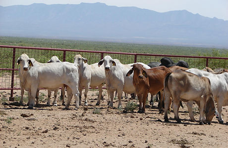
We then stopped to look at some adorable puppy-eared bramhan a native Indian cattle that they are experimenting with to see if they are better adapted for drier rangelands. The fellow mentioned that his lab believes they have isolated a gene that controls areas of use (uplands versus lowlands) in cattle.
We then moved over to the Jornada Experimental Range. At the first stop Kris Havstad discussed the sandy ecological site we were on and its associated state and transition model. The historical plant community is black grama dominated but through overgrazing or fire control various stages of mesquite invasion can be induced.
We were also introduced to the concept of pedoderm and pattern classes by Laura Burkett. These are an easy to observe, quick method of evaluating soil surface features and plant patterns that will influence how the ecosystem functions. They also provide a consistent means of characterizing a site for different interest groups. Pedoderm classes describe the soil surface in ways that imply the likelihood of plant establishment and nutrient and water retention. Resource retention classes describes the spatial patterns (patches and interpatches) of vascular plants. Vegetation patches may capture water and nutrients from interspaces, creating good habitat for more plant establishment. Large patch interspaces and connectivity between them provide transport pathways for water and nutrients from the site.
After this, we were taken to witness the setup for a thwarted unmanned aerial vehicle (UAV) flight. The wind speeds were too high to send these out to gather imagery. The staff explained how these aircraft could be used to gather high -resolution imagery of an area in monitoring and characterization efforts. This kind of imagery can be used to evaluate plant composition, restoration efforts, change in plant composition, phenology and hydrological processes in natural resource disciplines. The image resolution for single band(panchromatic) is 6-8 cm while for multispectral bands increases to 15-20 cm. Flights typically occur at 700 feet and the best time of flight is early morning when wind speed lower. Images have approximately 30-40 % overlaps at two dimensions, width and length. The plane flies each path twice, in case atmospheric turbulence causes a gap between adjacent images.
Next stop was an old prairie dog town. Prairie dogs had been mostly exterminated in the area because of government efforts in the 50s and 60s. Kris Havstad pointed out that they would not even try to classify this site as an ecological site because of its unique history of use that makes it anomalous.
After we picked up beer but before the end of the tour we drove out to one of the water tanks where a fish and game biologist awaited with a chiracahua leopard frog. He explained his efforts in saving these frogs from the chytrid fungus which plagues them. The biologist treats the fungus and then quarantines the frogs in places like Jornada water tanks. Here we also heard a plug for the criollo cattle, a small but hearty breed of cattle.
White Sands Missile Range Tour-
We departed Las Cruces in a large tour bus and headed east up to the summit of the Organ Mountains where we met our tour guide. The range lies in the Tularosa basin surrounded by the Organ, Oscutta, and San Andres Mountains. The Tularosa basin is made up of granitic and gypsum sandy soils blown down from the surrounding mountains with an underlying Mollisol base. Our First stop was just into the Missile range on the upper Bajada of the Organ Mountains which is primarily a black gramma grassland with scattered juniper and yucca bushes. Plants here include: Black Gramma, Plantago patagonicas, Tar bush, Flourensia cernua and mesquite. The second stop was on the abandoned Hal Cox ranch which was a dude ranch that ran sheep and cattle until the mid 50’s. THis ranch is located on the mid Bajada and comprised priamrily of Aridisols with plant communities of mesquite, dunegrass, sporobolis airodes, creosote bush, and salvia. On our way to the White Sands national Monument we descended through a creosote dominated shrubland, with scattered opuntia spp. Our final stop was at the White Sands National Monument where we examined the dune shrublands and the poplars that are able to grow due to the very high water table and near 100% humidity. THe Gypsum dunes are formed by wind blow gypsum crystals that are deposited onto lake Lucero. During heavy rain storms, the gypsum is washed down the creeks and drainages from the surrounding mountains and is deposited onto Lake Lucero. As the water evaporates, the minerals are formed into Crystals. High winds break down the soft cystals and as they tumble across the landscape they are ground into fine white gypsum crystals and deposited on to the dune field.